


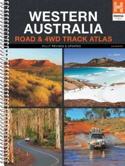


HEMA Western Australia Road & 4WD Track Atlas
Original price was: $34.95.$24.47Current price is: $24.47.
- Service that stands out, online and always timely.
- Experience the Best Quality
- Elevate Your Shopping Experience
- Quality products for every lifestyle.

HEMA Western Australia Road & 4WD Track Atlas Discover Australia’s largest state with the Western Australia Road & 4WD Track Atlas. Plan and navigate your trip with state-wide atlas mapping, which includes detailed coverage of Perth and Southwest Western Australia (WA). Find an adventure with a list of the state’s Top 50 4WD Trips, which each have a track grading, distances, contact information, and an atlas reference. There’s even detailed information on Western Australia’s Top 25 National Parks, including camping areas within each park, things to do, contact details, an inset map, and a rundown of what makes each park unique. To top it off, there is also a list of private camping areas and caravan parks, an index, and a list of all accredited visitor centres within Western Australia. Features Top 50 4WD Trips Top 25 WA National Parks Detailed mapping throughout the State (1:250,000) Caravan parks & dump points Camping and rest areas Truck Parking Visitor Centres Specifications Edition: 3rd Publication Date: 01/04/15 Number of Pages: 211 Height: 290mm Width: 230mm Depth: 20mm Weight: 0.95kg (9781865007328)
| SKU | 9781865007328 |
|---|---|
| Barcode # | 9781865007328 |
| Brand | HEMA |
| Shipping Weight | 1.2000kg |
Be the first to review “HEMA Western Australia Road & 4WD Track Atlas”
Related products


Reviews
There are no reviews yet.